|
Océan Atlantique nord (en gaëlique)
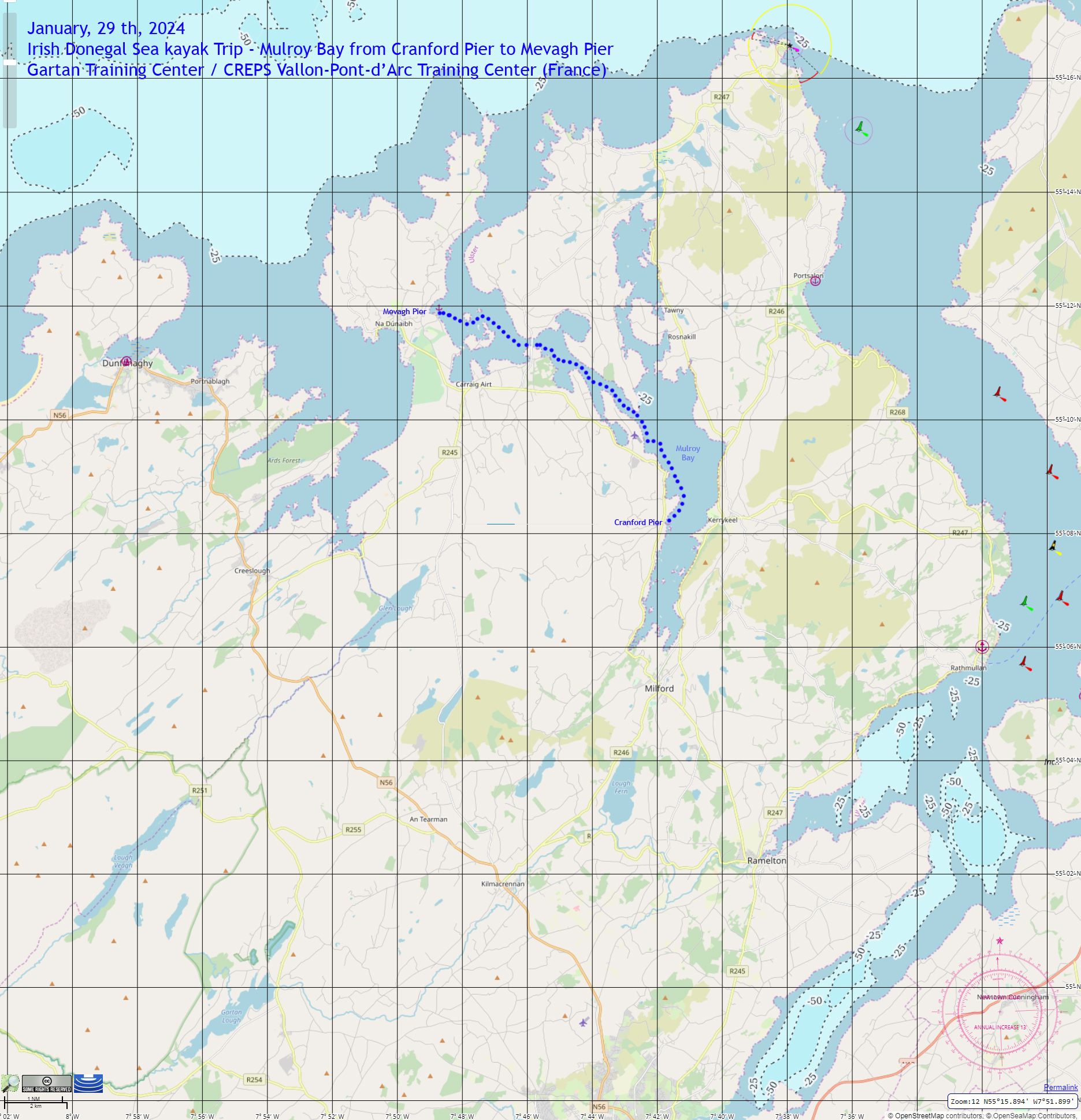
Après une première journée tranquille et ensoleillée sur le lac de Gartan Lough, les moniteurs stagiaires du centre de formation de Gartan en Irlande, accompagnés de l’équipe du CREPS, sont partis cette fois se frotter aux conditions océaniques sur la magnifique côte du Donegal sans cesse battue par le vent et la houle du large. Sous le regard attentif de leurs formateurs John et Marty, les stagiaires ont préparé la navigation en analysant toutes les données météorologiques disponibles et proposé une option de navigation grâce à des outils numériques performants mis à disposition par le centre. Avec un équipement adapté aux conditions locales, l’équipe a donc pu embarquer à Cranford pour se rendre à la pagaie jusqu’à Mevagh en empruntant les puissants courants de marées de l’estuaire de Mulroy malmenés par un fort vent contraire d’ouest. La gestion du groupe en mer, la capacité à adopter une position de leadership tout en assurant une sécurité permanente furent autant de compétences vérifiées par John, formateur attentif et bienveillant à l’égard de ses stagiaires qui aspirent à devenir de futurs guides de kayak de mer.
|
|
North Atlantic Ocean (in Gaelic)
After a calm and sunny first day on Gartan Lough, the trainee instructors from the Gartan training centre in Ireland, accompanied by the CREPS team, set off this time to test their mettle in ocean conditions on the magnificent Donegal coast, which is constantly battered by wind and swell from the open sea. Under the watchful eye of their instructors John and Marty, the trainees prepared for the navigation by analysing all the available weather data and proposing a navigation option using the high-performance digital tools provided by the centre. With equipment adapted to local conditions, the team embarked in Cranford to paddle to Mevagh on the powerful tidal currents of the Mulroy estuary, buffeted by a strong westerly headwind. Group management at sea, the ability to adopt a leadership position while ensuring constant safety were all skills tested by John, an attentive and caring trainer of his trainees who aspire to become future sea kayak guides.
|


